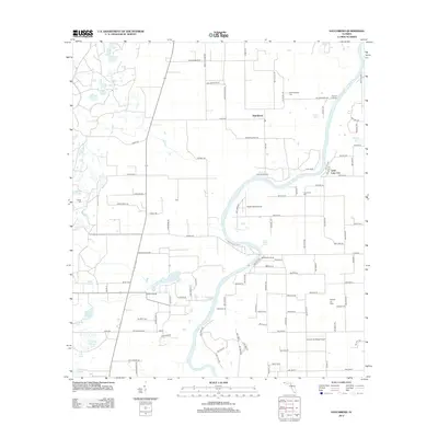
2012 Map of Hatchbend
USGS Topo · Published 2012About this map
The Suwannee River meanders through this section of Gilchrist County, defining a landscape shaped by hydrology and aviation at the start of the 2010s. The settlement of Hatchbend and the community of Little Lake City anchor the upland areas, while the river corridor is marked by significant natural springs including Fletcher Spring, Rock Bluff Spring, and Guaranto Spring. These freshwater features, paired with river access points like Simms Landing and Rock Bluff Landing, illustrate the importance of the river for local recreation and environmental character.
Find a feature on this map
105 named features on this map. Tap any name to fly to it.
Don’t see what you’re looking for? This feature index may not catch every label — zoom into the map to look around manually.
Map Details
Editions of this 2012 Hatchbend Map
This is the sole edition of this map. No revisions or reprints were ever made.
Other maps of this area

1954 · Cross City East
USGS Topo · 1:24,000

1954 · Mallory Swamp SE
USGS Topo · 1:24,000

1954 · Mallory Swamp NE
USGS Topo · 1:24,000

1954 · Gainesville
USGS Topo · 1:250,000

1956 · Mallory Swamp SE
USGS Topo · 1:25,000

1958 · Gainesville
USGS Topo · 1:250,000

1959 · Gainesville
USGS Topo · 1:250,000

1968 · Fourmile Lake
USGS Topo · 1:24,000

1968 · Branford
USGS Topo · 1:24,000

1968 · Hatchbend
USGS Topo · 1:24,000