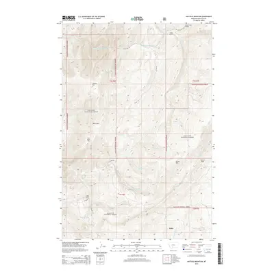
2014 Map of Hatfield Mountain
USGS Topo · Published 2014About this map
Gallatin National Forest dominates this mountain landscape in Gallatin County, characterized by high ridges and a network of named drainages. The small settlement of Sedan sits in the southeastern corner, serving as a landmark in an area otherwise defined by significant elevations like Hatfield Mtn and Red Rock Mtn. The transport pattern is dictated by the terrain, with Sixteen Mile Rd following the northern canyon and Petterson Rd providing access from the south. This area is heavily dissected by seasonal and perennial waters, including Middle Fork Sixteenmile Cr and Snowslide Cr. The map reveals the intersection of forestry management and early settlement routes, with topographic features such as Coal Gulch and Miller Gulch suggesting the local history of land use and extraction in these high-altitude basins.
Find a feature on this map
32 named features on this map. Tap any name to fly to it.
Don’t see what you’re looking for? This feature index may not catch every label — zoom into the map to look around manually.
Map Details
Editions of this 2014 Hatfield Mountain Map
This is the sole edition of this map. No revisions or reprints were ever made.
Other maps of this area

1886 · Fort Logan
USGS Topo · 1:250,000

1886 · Little Belt Mts.
USGS Topo · 1:250,000

1888 · Three Forks
USGS Topo · 1:250,000

1891 · Livingston
USGS Topo · 1:250,000

1893 · Livingston
USGS Topo · 1:250,000

1894 · Three Forks
USGS Topo · 1:250,000

1894 · Little Belt Mts.
USGS Topo · 1:250,000

1895 · Three Forks
USGS Topo · 1:250,000

1897 · Little Belt Mts.
USGS Topo · 1:250,000

1898 · Little Belt Mts.
USGS Topo · 1:250,000