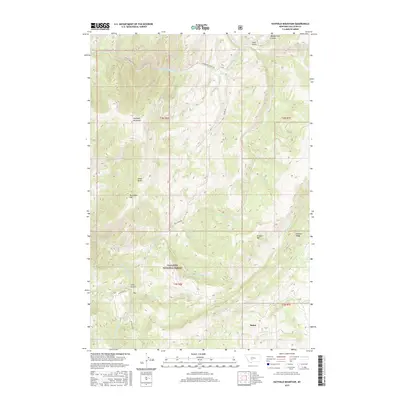
2017 Map of Hatfield Mountain
USGS Topo · Published 2017About this map
Hatfield Mountain and Red Rock Mtn dominate this high-elevation landscape in Gallatin County, defined by the deep drainages of the Gallatin National Forest. The settlement of Sedan sits at the southern edge of the quadrangle, where the terrain begins to transition from the steep gulches of the northern peaks toward more accessible valley floors. The drainage network is complex, characterized by the Middle Fork Sixteenmile Cr and various ephemeral and seasonal flows like Snowslide Cr and Dry Fork. Local travel is dictated by the topography, with roads such as Sixteen Mile Creek Rd and Petterson Rd following the natural contours of the gulches. This survey provides a precise look at the forest boundaries and township lines, including t4n r6e and t3n r7e, illustrating how public land management and private holdings intersect in the Montana backcountry.
Find a feature on this map
30 named features on this map. Tap any name to fly to it.
Don’t see what you’re looking for? This feature index may not catch every label — zoom into the map to look around manually.
Map Details
Editions of this 2017 Hatfield Mountain Map
This is the sole edition of this map. No revisions or reprints were ever made.
Other maps of this area

1886 · Fort Logan
USGS Topo · 1:250,000

1886 · Little Belt Mts.
USGS Topo · 1:250,000

1888 · Three Forks
USGS Topo · 1:250,000

1891 · Livingston
USGS Topo · 1:250,000

1893 · Livingston
USGS Topo · 1:250,000

1894 · Three Forks
USGS Topo · 1:250,000

1894 · Little Belt Mts.
USGS Topo · 1:250,000

1895 · Three Forks
USGS Topo · 1:250,000

1897 · Little Belt Mts.
USGS Topo · 1:250,000

1898 · Little Belt Mts.
USGS Topo · 1:250,000