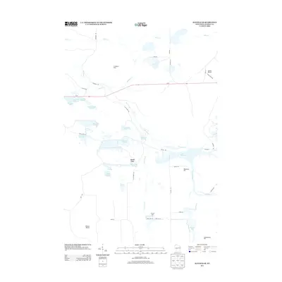
2013 Map of Hatfield SE
USGS Topo · Published 2013About this map
Speck Oaks sits at the heart of this marshy landscape in Jackson County, where a complex network of managed waterways and low hills defines the terrain. The region is characterized by an extensive system of flowages and pools, including Townline Flowage, Schwartz Pool, and the series of numbered and named wetlands like Seventeen Flowage and Mallard Flowage 1. These water bodies are fed and connected by several winding creeks, most notably Morrison Cr and Town Line Cr, which snake through the level ground between distinct elevations.
Find a feature on this map
47 named features on this map. Tap any name to fly to it.
Don’t see what you’re looking for? This feature index may not catch every label — zoom into the map to look around manually.
Map Details
Editions of this 2013 Hatfield SE Map
This is the sole edition of this map. No revisions or reprints were ever made.
Other maps of this area

1947 · Millston
USGS Topo · 1:62,500

1949 · Millston
USGS Topo · 1:62,500

1953 · Eau Claire
USGS Topo · 1:250,000

1957 · City Point
USGS Topo · 1:48,000

1958 · Eau Claire
USGS Topo · 1:250,000

1958 · Hatfield
USGS Topo · 1:48,000

1958 · Wyeville
USGS Topo · 1:48,000

1964 · Eau Claire
USGS Topo · 1:250,000
1970 · Hatfield SW
USGS Topo · 1:24,000

1970 · Spaulding
USGS Topo · 1:24,000