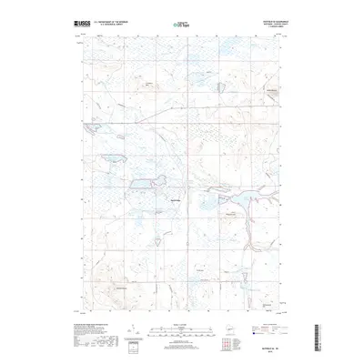
2018 Map of Hatfield SE
USGS Topo · Published 2018About this map
Speck Oaks sits at the heart of this landscape, surrounded by an intricate network of marshes and water management features in central Wisconsin. The area is defined by its extensive flowages and reservoirs, such as Townline Reservoir, Potter Flowage, and White-Tail Flowage, which dominate the hydrology between Morrison Cr and Crawford Cr. This concentration of managed wetlands and named marshes like City Marsh and Speck Marsh suggests a region historically utilized for cranberry cultivation or waterfowl management.
Find a feature on this map
46 named features on this map. Tap any name to fly to it.
Don’t see what you’re looking for? This feature index may not catch every label — zoom into the map to look around manually.
Map Details
Editions of this 2018 Hatfield SE Map
This is the sole edition of this map. No revisions or reprints were ever made.
Other maps of this area

1947 · Millston
USGS Topo · 1:62,500

1949 · Millston
USGS Topo · 1:62,500

1953 · Eau Claire
USGS Topo · 1:250,000

1957 · City Point
USGS Topo · 1:48,000

1958 · Eau Claire
USGS Topo · 1:250,000

1958 · Hatfield
USGS Topo · 1:48,000

1958 · Wyeville
USGS Topo · 1:48,000

1964 · Eau Claire
USGS Topo · 1:250,000
1970 · Hatfield SW
USGS Topo · 1:24,000

1970 · Spaulding
USGS Topo · 1:24,000