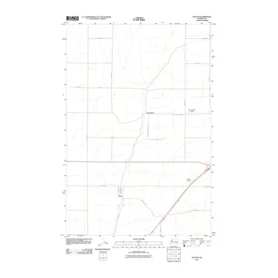
2011 Map of Hatton
USGS Topo · Published 2011About this map
Hatton and Cunningham are the primary points of reference in this high-plateau region of Adams County. The landscape is defined by the distinct erosional patterns of Hatton Coulee and Cunningham Coulee, which cut through the agricultural grid common to this part of the state. These coulees serve as the primary conduits for transportation and natural drainage, with major roads following the lower, protected elevations.
Find a feature on this map
23 named features on this map. Tap any name to fly to it.
Don’t see what you’re looking for? This feature index may not catch every label — zoom into the map to look around manually.
Map Details
Editions of this 2011 Hatton Map
This is the sole edition of this map. No revisions or reprints were ever made.
Other maps of this area

1916 · Connell
USGS Topo · 1:125,000

1918 · Connell
USGS Topo · 1:125,000

1953 · Walla Walla
USGS Topo · 1:250,000

1958 · Walla Walla
USGS Topo · 1:250,000
1970 · Frischknecht
USGS Topo · 1:24,000

1970 · Lind SW
USGS Topo · 1:24,000
1970 · Shano
USGS Topo · 1:24,000
1970 · Roxboro
USGS Topo · 1:24,000
1970 · Providence
USGS Topo · 1:24,000
1970 · Connell
USGS Topo · 1:24,000