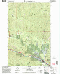
1999 Map of Haugan
USGS Topo · Published 2003About this map
Haugan serves as a small waypoint along the St Regis River in this high-country survey of the Coeur d'Alene Mountains. The landscape is defined by its industrial and agricultural history, particularly within the Lolo National Forest. Mining activity is evident through numerous claims and workings, including the Black Traveler Mine Prospect, Seltese Consolidated Mine, and East Coeur d'Alene Mine. A notable cultural feature is the Savenac Nursery, situated near the confluence of Savenac Creek and the river. The terrain is marked by prominent peaks such as Cruzane Mountain and Haugan Mountain, while the Storm Peak Trail provides a documented route through the high ridges. This map also preserves the administrative boundaries of the Sanders Co and Mineral Co line and the local ranger district divisions.
Find a feature on this map
36 named features on this map. Tap any name to fly to it.
Don’t see what you’re looking for? This feature index may not catch every label — zoom into the map to look around manually.
Map Details
Editions of this 1999 Haugan Map
This is the sole edition of this map. No revisions or reprints were ever made.
Other maps of this area

1914 · Avery
USGS Topo · 1:125,000

1917 · Avery
USGS Topo · 1:125,000

1918 · St Regis
USGS Topo · 1:125,000

1919 · St. Regis
USGS Topo · 1:125,000

1932 · Trout Creek
USGS Topo · 1:125,000

1935 · Trout Creek
USGS Topo · 1:125,000

1936 · Trout Creek
USGS Topo · 1:125,000

1937 · Thompson Falls
USGS Topo · 1:125,000

1937 · Thompson Falls
USGS Topo · 1:62,500

1956 · Cooper Gulch
USGS Topo · 1:62,500