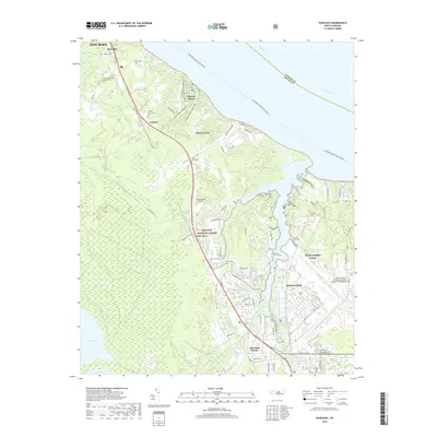
2019 Map of Havelock
USGS Topo · Published 2019About this map
MCAS Cherry Point and the adjacent Havelock community dominate this coastal landscape, showing the integration of military infrastructure and residential development along the Slocum Creek drainage. The eastern portion of the map is defined by the Cherry Point Marine Corps Air Station, while the western reach is largely preserved within the Croatan National Forest. Local history is preserved in several small burial sites, including the Croatan Community Cem and the Rowe Family Cem. The geography is characterized by intricate aquatic features such as Alligator Gut, Gum Swamp, and the wide Neuse River, which forms the northeastern boundary. Significant transit corridors like W Main St connect Havelock Station to northern points like Riverdale and Croatan, illustrating the region's growth as a military and maritime hub.
Find a feature on this map
95 named features on this map. Tap any name to fly to it.
Don’t see what you’re looking for? This feature index may not catch every label — zoom into the map to look around manually.
Map Details
Editions of this 2019 Havelock Map
This is the sole edition of this map. No revisions or reprints were ever made.
Other maps of this area

1901 · New Bern
USGS Topo · 1:62,500

1903 · New Bern
USGS Topo · 1:62,500

1942 · Maysville
USGS Topo · 1:62,500

1948 · Maysville
USGS Topo · 1:62,500

1949 · Havelock
USGS Topo · 1:24,000

1949 · Newport
USGS Topo · 1:24,000

1949 · Cherry Point
USGS Topo · 1:24,000

1949 · Masontown
USGS Topo · 1:24,000

1950 · New Bern
USGS Topo · 1:24,000

1950 · Upper Broad Creek
USGS Topo · 1:24,000
Featured Places
- New Bern, NC
- Havelock, NC
- Carolina Pines, Neuse Forest
- Havelock Station, Havelock
- Ketner Heights, Havelock