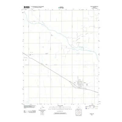
2009 Map of Haven
USGS Topo · Published 2009About this map
Haven and Yoder anchor this south-central Kansas landscape, where the agricultural grid is intersected by the wide path of the Arkansas River. The settlement pattern reflects the region’s heritage, particularly evident in the presence of the Mennonite Cemetery and Laurel Cemetery. In the northeast corner of the quadrangle, the Burrton Oil Field indicates the subsurface industrial activity that complements the area's farming roots.
Find a feature on this map
33 named features on this map. Tap any name to fly to it.
Don’t see what you’re looking for? This feature index may not catch every label — zoom into the map to look around manually.
Map Details
Editions of this 2009 Haven Map
This is the sole edition of this map. No revisions or reprints were ever made.
Other maps of this area

1889 · Cheney
USGS Topo · 1:125,000

1891 · Hutchinson
USGS Topo · 1:125,000

1891 · Cheney
USGS Topo · 1:125,000

1893 · Hutchinson
USGS Topo · 1:125,000

1901 · Cheney
USGS Topo · 1:125,000

1955 · Wichita
USGS Topo · 1:250,000

1955 · Hutchinson
USGS Topo · 1:250,000

1958 · Wichita
USGS Topo · 1:250,000

1958 · Patterson
USGS Topo · 1:24,000

1959 · Hutchinson
USGS Topo · 1:250,000