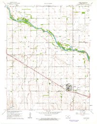
1961 Map of Haven
USGS Topo · Published 1962About this map
The Arkansas River cuts diagonally across this central Kansas landscape, shaping the development and drainage of Reno County during the early 1960s. The town of Haven serves as a primary hub, characterized by its grain-adjacent infrastructure and the Missouri Pacific railroad line that bisects the territory. The map reveals a deeply rooted rural community, evidenced by the clustered institutions near the settlement of Yoder, including the Yoder Ch, German Sch, and the Mennonite Cem.
Find a feature on this map
24 named features on this map. Tap any name to fly to it.
Don’t see what you’re looking for? This feature index may not catch every label — zoom into the map to look around manually.
Map Details
Editions of this 1961 Haven Map
This is the sole edition of this map. No revisions or reprints were ever made.
Other maps of this area

1889 · Cheney
USGS Topo · 1:125,000

1891 · Hutchinson
USGS Topo · 1:125,000

1891 · Cheney
USGS Topo · 1:125,000

1893 · Hutchinson
USGS Topo · 1:125,000

1901 · Cheney
USGS Topo · 1:125,000

1955 · Wichita
USGS Topo · 1:250,000

1955 · Hutchinson
USGS Topo · 1:250,000

1958 · Wichita
USGS Topo · 1:250,000

1958 · Patterson
USGS Topo · 1:24,000

1959 · Hutchinson
USGS Topo · 1:250,000