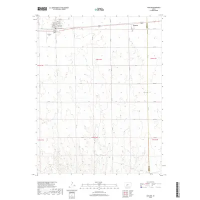
2018 Map of Haviland
USGS Topo · Published 2018About this map
Haviland serves as the primary hub of this 2018 survey, organized by a precise grid of residential streets including Cherry St, Poplar St, and Walnut St. The landscape transitions from the concentrated settlement at Haviland to the smaller cluster of Wellsford to the east, illustrating the enduring agricultural character of the region. Transportation remains central to the area's layout, anchored by the Gail Ballard Airport and the east-west corridor of Highway 54/400. To the south and east, the terrain is defined by the drainage patterns of Spring Cr and Soldier Cr. Genealogists and local historians can find the Boles Cem located near the border of Kiowa Co and Pratt Co, providing a specific point of interest for tracing family roots in this corner of rural Kansas.
Find a feature on this map
53 named features on this map. Tap any name to fly to it.
Don’t see what you’re looking for? This feature index may not catch every label — zoom into the map to look around manually.
Map Details
Editions of this 2018 Haviland Map
This is the sole edition of this map. No revisions or reprints were ever made.
Other maps of this area

1889 · Kinsley
USGS Topo · 1:125,000

1891 · Medicine Lodge
USGS Topo · 1:125,000

1892 · Kinsley
USGS Topo · 1:125,000

1892 · Coldwater
USGS Topo · 1:125,000

1892 · Pratt
USGS Topo · 1:125,000

1893 · Medicine Lodge
USGS Topo · 1:125,000

1894 · Kinsley
USGS Topo · 1:125,000

1894 · Pratt
USGS Topo · 1:125,000

1955 · Pratt
USGS Topo · 1:250,000

1959 · Pratt
USGS Topo · 1:250,000