1968 Map of Haviland NW
USGS Topo · Published 1984About this map
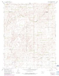
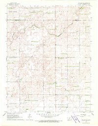
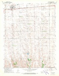
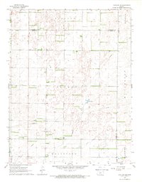
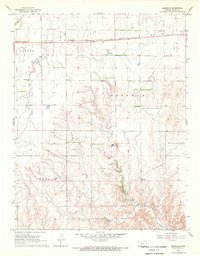
Rattlesnake Creek and its tributary, the East Fork Rattlesnake Creek, define the topography of this rural landscape in south-central Kansas. Situated along the border of Edwards and Kiowa counties, the terrain is characterized by the agricultural and industrial infrastructure of the late 1960s, with revisions captured into the early 1980s. The map shows a network of section lines and a prominent Pipeline cutting through the open country. Pockets of industrial activity are visible through scattered Oil Wells and other markers, while the township divisions of South Brown and Franklin provide the primary geographical framework. The presence of multiple pipelines and wells indicates the persistent role of the energy sector in shaping the use of these plains during the post-war era.
Find a feature on this map
8 named features on this map. Tap any name to fly to it.
Don’t see what you’re looking for? This feature index may not catch every label — zoom into the map to look around manually.
Map Details
Editions of this 1968 Haviland NW Map
2 editions found
Other maps of this area

1889 · Kinsley
USGS Topo · 1:125,000

1892 · Kinsley
USGS Topo · 1:125,000

1894 · Kinsley
USGS Topo · 1:125,000

1955 · Pratt
USGS Topo · 1:250,000

1959 · Pratt
USGS Topo · 1:250,000
1968 · Haviland NW
USGS Topo · 1:24,000
1968 · Haviland
USGS Topo · 1:24,000
1968 · Haviland NE
USGS Topo · 1:24,000
1968 · Brenham
USGS Topo · 1:24,000
1969 · Greensburg
USGS Topo · 1:24,000