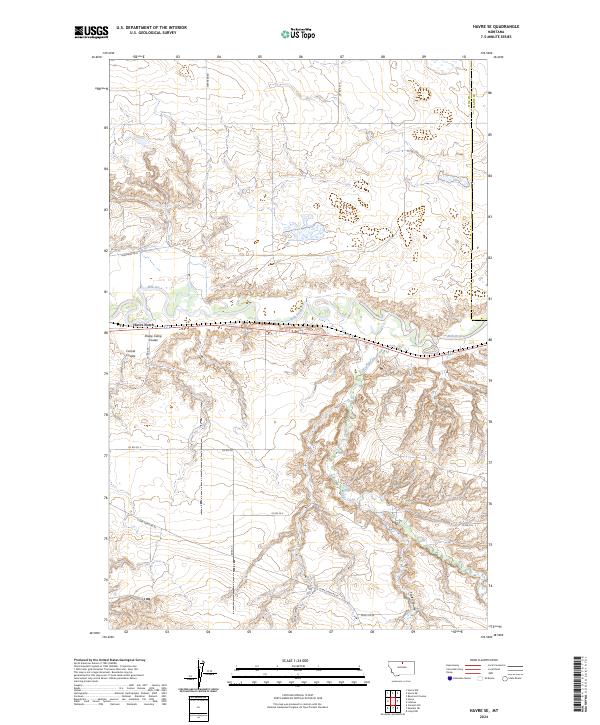
2024 Map of Havre SE
USGS Topo · Published 2024About this map
The Milk River winds through the northern portion of this landscape, just east of the Havre North area. This terrain is defined by a complex network of coulees, including Sheep Camp Coulee and Carnahan Coulee, which cut through the high plains toward the river valley. The map documents the boundary between Hill Co and Blaine Co as it runs north-south through the eastern edge of the quadrangle.
Find a feature on this map
21 named features on this map. Tap any name to fly to it.
Don’t see what you’re looking for? This feature index may not catch every label — zoom into the map to look around manually.
Map Details
Editions of this 2024 Havre SE Map
This is the sole edition of this map. No revisions or reprints were ever made.
Other maps of this area

1904 · Yantic
USGS Topo · 1:62,500

1904 · Havre
USGS Topo · 1:62,500

1912 · Zurich
USGS Topo · 1:125,000

1912 · Thibedeau Lake
USGS Topo · 1:125,000

1953 · Havre
USGS Topo · 1:250,000

1956 · Lloyd
USGS Topo · 1:62,500

1957 · Havre
USGS Topo · 1:250,000

1958 · Havre
USGS Topo · 1:250,000

1959 · Shambo
USGS Topo · 1:62,500

1964 · Havre NW
USGS Topo · 1:24,000