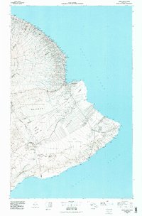
1980 Map of Hawaii County Sheet 2
USGS Topo · Published 1985About this map
The volcanic landscape of the Big Island dominates this survey, centered on the activity of Kilauea Crater and the vast Hawaii Volcanoes National Park. From the shoreline at Cape Kumukahi to the high reaches of the Hilo Forest Reserve, the map captures the transition from rugged volcanic terrain to the established coastal settlements of the Hilo and Puna districts. The city of Hilo serves as the regional hub, supported by infrastructure like General Lyman Field and Hilo Bay. Along the Hamakua Coast, a string of agricultural and plantation-era settlements like Laupahoehoe, Pepeekeo, and Papaikou follow the coastline, intersected by numerous deep-cut stream gulches such as Maulua Gulch and Honohina Gulch. In the Puna district, the map details the geometric layouts of inland developments like Elevenmile Homesteads and the coastal village of Kalapana before modern lava flows altered the topography.
Find a feature on this map
192 named features on this map. Tap any name to fly to it.
Don’t see what you’re looking for? This feature index may not catch every label — zoom into the map to look around manually.
Map Details
Editions of this 1980 Hawaii County Sheet 2 Map
This is the sole edition of this map. No revisions or reprints were ever made.
Other maps of this area

1915 · Hamakua
USGS Topo · 1:62,500

1915 · Honomu
USGS Topo · 1:62,500

1917 · Hilo
USGS Topo · 1:62,500

1921 · Kilauea
USGS Topo · 1:62,500

1922 · Puna
USGS Topo · 1:62,500

1923 · Pahala
USGS Topo · 1:62,500

1924 · Makuu
USGS Topo · 1:62,500

1924 · Kilauea
USGS Topo · 1:62,500

1924 · Puna
USGS Topo · 1:62,500

1924 · Kalapana
USGS Topo · 1:62,500