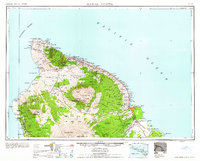
1961 Map of Hawaii North
USGS Topo · Published 1961About this map
The volcanic peaks of Mauna Kea and Mauna Loa dominate this mid-century view of the Big Island, illustrating the profound relationship between the islands' geology and its agricultural economy. Along the northeast Hamakua Coast, a dense network of sugar infrastructure is visible, including the Pacific Sugar Mill, Honokaa Mill, and Olaa Plantation. These industrial hubs are connected by the remnants of the Hawaii Consolidated railroad, which historically moved cane to the deep-water facilities at Hilo Harbor.
Find a feature on this map
156 named features on this map. Tap any name to fly to it.
Don’t see what you’re looking for? This feature index may not catch every label — zoom into the map to look around manually.
Map Details
Editions of this 1961 Hawaii North Map
2 editions found

Other maps of this area

1913 · Kohala
USGS Topo · 1:62,500

1915 · Hamakua
USGS Topo · 1:62,500

1915 · Honomu
USGS Topo · 1:62,500

1916 · Kohala
USGS Topo · 1:62,500

1916 · Waipio
USGS Topo · 1:62,500

1917 · Hilo
USGS Topo · 1:62,500

1921 · Kilauea
USGS Topo · 1:62,500

1922 · Puna
USGS Topo · 1:62,500

1924 · Makuu
USGS Topo · 1:62,500

1924 · Kilauea
USGS Topo · 1:62,500