
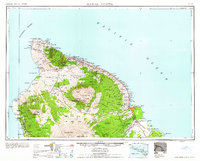
1961 Map of Hawaii North
USGS Topo · Published 1961About this map
Mauna Kea and Mauna Loa dominate the northern half of the Big Island, their massive slopes detailed with cinder cones and expansive lava flows from the nineteenth century. Along the rugged northern coast, the sugar industry is evidenced by the Kohala Mill, Pacific Sugar Mill, and Paauilo Mill, supported by a complex network of irrigation infrastructure including the Hamakua Ditch and Lower Hamakua Ditch. The map illustrates a landscape of sharp contrasts, from the dense coastal settlements around Hilo Harbor and Kailua to the remote ranching lands of Puu Hue Ranch and Huehue Ranch. Cultural history is preserved through labels like the Ahu a Umi Heiau Ruins, while the Hawaii Consolidated rail line traces the windward coast. Numerous forest reserves, such as the Kohala Forest Reserve and Olaa Forest Reserve, protect the upland watersheds above the coastal landings.
Find a feature on this map
190 named features on this map. Tap any name to fly to it.
Don’t see what you’re looking for? This feature index may not catch every label — zoom into the map to look around manually.
Map Details
Editions of this 1961 Hawaii North Map
2 editions found
Other maps of this area

1913 · Kohala
USGS Topo · 1:62,500

1915 · Hamakua
USGS Topo · 1:62,500

1915 · Honomu
USGS Topo · 1:62,500

1916 · Kohala
USGS Topo · 1:62,500

1916 · Waipio
USGS Topo · 1:62,500

1917 · Hilo
USGS Topo · 1:62,500

1921 · Kilauea
USGS Topo · 1:62,500

1922 · Puna
USGS Topo · 1:62,500

1924 · Makuu
USGS Topo · 1:62,500

1924 · Kilauea
USGS Topo · 1:62,500