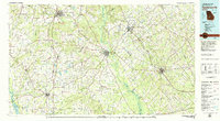
1978 Map of Hawkinsville
USGS Topo · Published 1979About this map
The Ocmulgee River carves a winding path through the center of this Georgia landscape, serving as a primary corridor for the regions of Hawkinsville and Cochran. The late 1970s environment is defined by its agricultural and transit networks, where the intersection of several railroads—including the Central, Georgia, and Southern lines—connected rural hubs like Marshallville and Vienna to the wider state economy. To the southwest, the waters of Blackshear Lake and Hogcrawl Creek highlight the importance of water management and recreation in the Middle Georgia coastal plain.
Find a feature on this map
101 named features on this map. Tap any name to fly to it.
Don’t see what you’re looking for? This feature index may not catch every label — zoom into the map to look around manually.
Map Details
Editions of this 1978 Hawkinsville Map
This is the sole edition of this map. No revisions or reprints were ever made.
Other maps of this area

1953 · Dothan
USGS Topo · 1:250,000

1953 · Waycross
USGS Topo · 1:250,000

1954 · Dothan
USGS Topo · 1:250,000

1955 · Dothan
USGS Topo · 1:250,000

1955 · Phenix City
USGS Topo · 1:250,000

1956 · Fort Valley
USGS Topo · 1:62,500

1956 · Cochran
USGS Topo · 1:62,500

1956 · Perry
USGS Topo · 1:62,500

1956 · Warner Robins
USGS Topo · 1:62,500

1956 · Jeffersonville
USGS Topo · 1:62,500