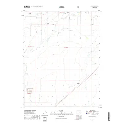
2019 Map of Hawley
USGS Topo · Published 2019About this map
Agricultural water management dominates this high plains landscape south of the Arkansas River in Otero County. The settlement of Hawley sits at the junction of several county roads, serving as a hub for the intricate irrigation network that includes the Rocky Ford Highline Canal, Catlin Canal, and Otero Canal. These man-made waterways cut across the natural drainage of Timpas Cr and Crooked Arroyo, illustrating the extensive engineering required to support farming in this semi-arid region. In the south, the terrain transitions into the Comanche National Grassland, where the land becomes more open and less developed. Smaller communities like Roberta and Benton are situated along these vital water routes and arroyos, such as Benton Arroyo, marking the steady pattern of rural settlement along the county's north-south road grid.
Find a feature on this map
32 named features on this map. Tap any name to fly to it.
Don’t see what you’re looking for? This feature index may not catch every label — zoom into the map to look around manually.
Map Details
Editions of this 2019 Hawley Map
This is the sole edition of this map. No revisions or reprints were ever made.
Other maps of this area

1891 · Catlin
USGS Topo · 1:125,000

1891 · Timpas
USGS Topo · 1:125,000

1893 · Catlin
USGS Topo · 1:125,000

1894 · Timpas
USGS Topo · 1:125,000

1953 · Cheraw
USGS Topo · 1:24,000

1954 · Manzanola
USGS Topo · 1:24,000

1954 · Lamar
USGS Topo · 1:250,000

1955 · Rocky Ford
USGS Topo · 1:24,000

1955 · La Junta
USGS Topo · 1:250,000

1958 · La Junta
USGS Topo · 1:250,000