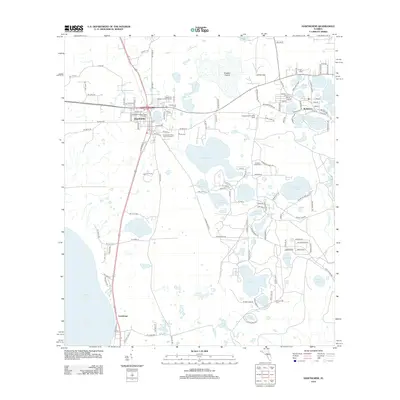
2012 Map of Hawthorne
USGS Topo · Published 2012About this map
Hawthorne serves as the primary hub in this early 21st-century survey of Alachua County, where the intersection of several regional routes anchors the local geography. The landscape is defined by an extensive lacustrine system, most notably the northern reaches of Lochloosa Lake and a dense cluster of smaller bodies like Lake Jeffords, Little Orange Lake, and Bream Lake. This watery terrain is punctuated by Fowlers Prairie to the north, suggesting the complex drainage patterns of North Central Florida's interior.
Find a feature on this map
140 named features on this map. Tap any name to fly to it.
Don’t see what you’re looking for? This feature index may not catch every label — zoom into the map to look around manually.
Map Details
Editions of this 2012 Hawthorne Map
This is the sole edition of this map. No revisions or reprints were ever made.
Other maps of this area

1893 · Citra
USGS Topo · 1:62,500

1895 · Citra
USGS Topo · 1:62,500

1915 · Interlachen
USGS Topo · 1:48,000

1916 · Interlachen
USGS Topo · 1:62,500

1938 · Hawthorn
USGS Topo · 1:48,000

1943 · Hawthorn
USGS Topo · 1:62,500

1944 · Interlachen
USGS Topo · 1:62,500

1949 · Keuka
USGS Topo · 1:24,000
1949 · Putnam Hall
USGS Topo · 1:24,000

1949 · Interlachen
USGS Topo · 1:62,500