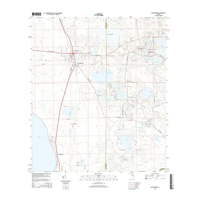
2015 Map of Hawthorne
USGS Topo · Published 2015About this map
Hawthorne sits at the intersection of local history and a complex lacustrine environment in North Central Florida. This landscape is defined by its numerous water bodies, ranging from the large Lochloosa Lake in the southwest to the smaller Johnson Lake and McMeekin Lake further east. The settlement patterns are punctuated by rural burial grounds such as Gilgal Cem and Drummond Cem, providing vital reference points for genealogists. The presence of Fowlers Prairie and Fowlers Lake in the north indicates the fluctuating wetlands characteristic of the Alachua and Putnam County border region. Smaller hamlets like Lochloosa and McMeekin highlight the dispersed nature of the population in this era, while the Hawthorne Baptist Church serves as a central landmark for the primary township. The intricate web of county roads, including SE Hawthorne Rd, connects these isolated water-bound communities.
Find a feature on this map
113 named features on this map. Tap any name to fly to it.
Don’t see what you’re looking for? This feature index may not catch every label — zoom into the map to look around manually.
Map Details
Editions of this 2015 Hawthorne Map
This is the sole edition of this map. No revisions or reprints were ever made.
Other maps of this area

1893 · Citra
USGS Topo · 1:62,500

1895 · Citra
USGS Topo · 1:62,500

1915 · Interlachen
USGS Topo · 1:48,000

1916 · Interlachen
USGS Topo · 1:62,500

1938 · Hawthorn
USGS Topo · 1:48,000

1943 · Hawthorn
USGS Topo · 1:62,500

1944 · Interlachen
USGS Topo · 1:62,500

1949 · Keuka
USGS Topo · 1:24,000
1949 · Putnam Hall
USGS Topo · 1:24,000

1949 · Interlachen
USGS Topo · 1:62,500