2024 Map of Hawthorne
USGS Topo · Published 2024About this map
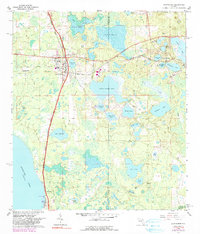
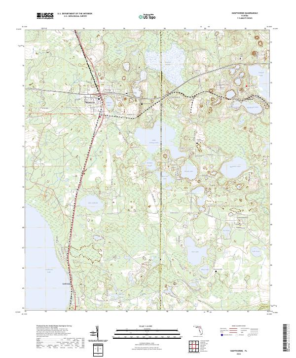
Hawthorne and the neighboring settlement of McMeekin define this North Florida landscape, where the town layout meets a complex network of wetlands and conservation lands. The map details a region transitioning from established residential centers to significant ecological preserves, including the Lochloosa Wildlife Conservation Area Trl and the Gainesville-Hawthorne State Trl. For genealogists, the map is particularly useful for locating smaller burial grounds such as Gilgal Cem, Morrison Cem, and Drummond Cem, often situated near family-named water bodies like Johnson Lake and Riley Lake. The eastern edge is dominated by a dense cluster of lakes, including Cowpen Lake, Redwater Lake, and McMeekin Lake, which historically influenced the development and isolation of local homesteads. These hydrological features, combined with the presence of Stanley Prairie and Fowlers Prairie, illustrate the persistent wet-prairie character of the Alachua and Putnam county borderlands.
Find a feature on this map
132 named features on this map. Tap any name to fly to it.
Don’t see what you’re looking for? This feature index may not catch every label — zoom into the map to look around manually.
Map Details
Editions of this 2024 Hawthorne Map
This is the sole edition of this map. No revisions or reprints were ever made.