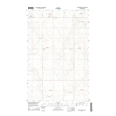
2014 Map of Hawthorne School
USGS Topo · Published 2014About this map
Hawthorne School stands as a focal point in this portion of Toole County, where the high plains are carved by an intricate network of coulees and seasonal creeks. The landscape is defined by the drainage patterns of Willow Cr and Trail Cr, which weave between family-named landmarks like Miners Coulee and Fernell Coulee. The rectilinear grid of the Public Land Survey System is overlaid by a sparse road network that connects isolated ranching interests, including Gus Blaze Rd and Eide Ranch Rd. Transportation across this section of Northern Montana is anchored by the Oilmont Hwy in the north. The presence of Eide School Rd suggests the historical footprint of rural education and community centers that once served these remote homesteads and agricultural tracts.
Find a feature on this map
24 named features on this map. Tap any name to fly to it.
Don’t see what you’re looking for? This feature index may not catch every label — zoom into the map to look around manually.
Map Details
Editions of this 2014 Hawthorne School Map
This is the sole edition of this map. No revisions or reprints were ever made.
Other maps of this area

1943 · Antelope Coulee
USGS Topo · 1:62,500

1945 · West Butte
USGS Topo · 1:62,500

1954 · Shelby
USGS Topo · 1:250,000

1958 · Shelby
USGS Topo · 1:250,000

1962 · Cameron Lake
USGS Topo · 1:24,000

1962 · Hawthorne School
USGS Topo · 1:24,000

1962 · Berkholder Reservoir
USGS Topo · 1:24,000

1962 · Mc Carters Lake
USGS Topo · 1:24,000

1962 · Mc Carters Lake SE
USGS Topo · 1:24,000

1962 · Grassy Butte
USGS Topo · 1:24,000