
1962 Map of Grassy Butte
USGS Topo · Published 1964About this map
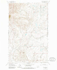
Middle Butte and Gold Butte dominate this northern Montana landscape, situated along the county line between Toole Co and Liberty Co. The terrain is defined by a dense network of coulees and seasonal water sources, such as Jack McDonald Coulee and Sleeper Coulee, which drain toward the larger Big Coulee. This 1962 field-checked survey reveals an era of established ranching and nascent energy infrastructure, marked by family-named properties like the T C Morris Ranch and Purnell Ranch alongside several gas wells and an aboveground pipeline. The presence of Chicago Lake and various springs, including Alkali Spring and Strawberry Spring, highlights the critical importance of water management for the livestock operations that utilized the trails and the Whitlash Road across this arid range.
Find a feature on this map
32 named features on this map. Tap any name to fly to it.
Don’t see what you’re looking for? This feature index may not catch every label — zoom into the map to look around manually.
Map Details
Editions of this 1962 Grassy Butte Map
2 editions found
Other maps of this area

1954 · Shelby
USGS Topo · 1:250,000

1958 · Shelby
USGS Topo · 1:250,000

1962 · Whitlash
USGS Topo · 1:24,000

1962 · Cameron Lake
USGS Topo · 1:24,000

1962 · Hawthorne School
USGS Topo · 1:24,000

1962 · Berkholder Reservoir
USGS Topo · 1:24,000

1962 · Blair Ranch
USGS Topo · 1:24,000

1962 · Fey Lakes
USGS Topo · 1:24,000
1962 · Hawley Hill
USGS Topo · 1:24,000

1962 · Haystack Butte
USGS Topo · 1:24,000