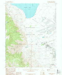
1987 Map of Hawthorne West
USGS Topo · Published 1987About this map
The eastern slopes of the Wassuk Range descend into the Walker Lake Valley, defining the landscape of this 1980s military and industrial corridor. The Hawthorne Army Ammunition Plant dominates the valley floor, south of the receding shoreline of Walker Lake at Navy Beach. This facility, alongside the Hawthorne Naval Base, represents a significant military footprint that shaped local infrastructure and the adjacent settlement of Babbitt. Water management is central to this arid environment, evidenced by the Black Beauty Reservoir, Cat Creek Reservoir, and Rose Creek Reservoir tucked into the canyons. Notable local amenities of the era include a golf course, an Athletic Field, and the Hawthorne Municipal Airport, providing a glimpse into the social and logistical life of this high-desert installation.
Find a feature on this map
28 named features on this map. Tap any name to fly to it.
Don’t see what you’re looking for? This feature index may not catch every label — zoom into the map to look around manually.
Map Details
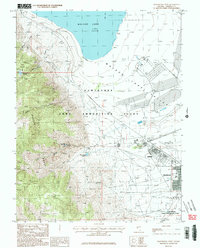
Editions of this 1987 Hawthorne West Map
2 editions found
Other maps of this area

1909 · Hawthorne
USGS Topo · 1:250,000

1911 · Hawthorne
USGS Topo · 1:250,000

1915 · Hawthorne
USGS Topo · 1:250,000

1948 · Walker Lake
USGS Topo · 1:250,000

1955 · Powell Mtn
USGS Topo · 1:62,500

1955 · Hawthorne
USGS Topo · 1:62,500

1956 · Mt. Grant
USGS Topo · 1:62,500

1956 · Aurora
USGS Topo · 1:62,500

1957 · Walker Lake
USGS Topo · 1:250,000

1962 · Walker Lake
USGS Topo · 1:250,000