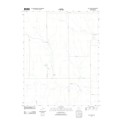
2012 Map of Hay Canyon
USGS Topo · Published 2012About this map
Pawnee River meanders across this rural section of Finney County, defining a landscape shaped by intermittent watercourses and agricultural grid lines. The terrain is marked by the namesake Hay Canyon and the winding path of Cottonwood Cr in the northern reaches, illustrating the drainage patterns of the High Plains. While Finney Lake provides a localized catchment, the majority of the area is organized by a network of gravel and section roads named for local families and early settlers. Names such as N Tom Reed Rd, Reed Rd, and E Guy Reed Rd suggest deep-rooted land ownership patterns, while routes like Alamota Rd and N Byler Rd provide the essential transit infrastructure between isolated farmsteads in the early 21st century.
Find a feature on this map
17 named features on this map. Tap any name to fly to it.
Don’t see what you’re looking for? This feature index may not catch every label — zoom into the map to look around manually.
Map Details
Editions of this 2012 Hay Canyon Map
This is the sole edition of this map. No revisions or reprints were ever made.
Other maps of this area

1955 · Scott City
USGS Topo · 1:250,000

1958 · Scott City
USGS Topo · 1:250,000

1974 · Ravanna
USGS Topo · 1:24,000
1974 · Horse Thief Canyon SW
USGS Topo · 1:24,000
1974 · Kalvesta
USGS Topo · 1:24,000

1974 · Dighton SW
USGS Topo · 1:24,000

1974 · Hay Canyon
USGS Topo · 1:24,000

1974 · Beeler SW
USGS Topo · 1:24,000

1974 · Dighton SE
USGS Topo · 1:24,000
1974 · Kalvesta SW
USGS Topo · 1:24,000