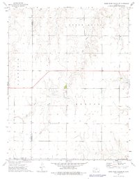
1974 Map of Horse Thief Canyon SW
USGS Topo · Published 1976About this map
Sand Creek meanders through the high plains of western Kansas in this mid-1970s topographical record. The landscape is defined by the transition between several townships, including North Roscoe, South Roscoe, Benton, and Garfield. This area, where the borders of Finney, Hodgeman, and Gray counties converge, reflects a rural economy rooted in land management and resource extraction. Evidence of local industry is scattered across the terrain in the form of several Gravel Pits, a Caliche Pit, and a Sandpit, while a network of rural roads and highway 156 provide the primary infrastructure for the region's agricultural and industrial transport. The placement of numerous wells further indicates the vital importance of groundwater in this arid corner of the state.
Find a feature on this map
13 named features on this map. Tap any name to fly to it.
Don’t see what you’re looking for? This feature index may not catch every label — zoom into the map to look around manually.
Map Details
Editions of this 1974 Horse Thief Canyon SW Map
This is the sole edition of this map. No revisions or reprints were ever made.
Other maps of this area

1892 · Dodge
USGS Topo · 1:125,000

1955 · Dodge City
USGS Topo · 1:250,000

1955 · Scott City
USGS Topo · 1:250,000

1958 · Dodge City
USGS Topo · 1:250,000

1958 · Scott City
USGS Topo · 1:250,000

1959 · Dodge City
USGS Topo · 1:250,000

1968 · Dodge City NE
USGS Topo · 1:24,000

1968 · Dodge City NW
USGS Topo · 1:24,000

1968 · Cimarron NE
USGS Topo · 1:24,000
1970 · Horse Thief Canyon
USGS Topo · 1:24,000