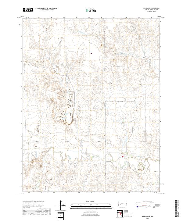
2022 Map of Hay Canyon
USGS Topo · Published 2022About this map
Finney Lake and the meandering course of the Pawnee River anchor this portion of Finney County, where the plains are broken by the drainage of Hay Canyon. The landscape is organized by a precise grid of rural section roads, many bearing family names that speak to the area's agricultural heritage, such as N Tom Reed Rd, E Guy Reed Rd, and N Byler Rd. In the northern half of the quadrangle, Cottonwood Cr cuts through the terrain, illustrating the critical role of intermittent water sources in this part of Kansas.
Find a feature on this map
21 named features on this map. Tap any name to fly to it.
Don’t see what you’re looking for? This feature index may not catch every label — zoom into the map to look around manually.
Map Details
Editions of this 2022 Hay Canyon Map
This is the sole edition of this map. No revisions or reprints were ever made.
Other maps of this area

1955 · Scott City
USGS Topo · 1:250,000

1958 · Scott City
USGS Topo · 1:250,000

1974 · Ravanna
USGS Topo · 1:24,000
1974 · Horse Thief Canyon SW
USGS Topo · 1:24,000
1974 · Kalvesta
USGS Topo · 1:24,000

1974 · Dighton SW
USGS Topo · 1:24,000

1974 · Hay Canyon
USGS Topo · 1:24,000

1974 · Beeler SW
USGS Topo · 1:24,000

1974 · Dighton SE
USGS Topo · 1:24,000
1974 · Kalvesta SW
USGS Topo · 1:24,000