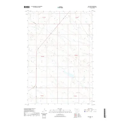
2017 Map of Hay Creek
USGS Topo · Published 2017About this map
Hay Cr and its many tributaries, including Bull Cr and Jones Cr, weave through this rural landscape in Harding County during the late 2010s. The area is defined by a sparse network of roads that follow the section lines and topography of the drainage basins, including Brown-Johnson Rd and Old Hwy 85. This portion of South Dakota reflects a traditional rangeland pattern where the hydrology of creeks like Boxelder Cr and Sheep Cr dictated the placement of local routes. The map detail provides a clear view of the township and range system, showing the surveyed divisions of T21N R5E and surrounding sections, which is essential for understanding land ownership and agricultural boundaries in this corner of the state.
Find a feature on this map
17 named features on this map. Tap any name to fly to it.
Don’t see what you’re looking for? This feature index may not catch every label — zoom into the map to look around manually.
Map Details
Editions of this 2017 Hay Creek Map
This is the sole edition of this map. No revisions or reprints were ever made.
Other maps of this area

1935 · Reva
USGS Topo · 1:125,000

1935 · Buffalo
USGS Topo · 1:125,000

1954 · Lemmon
USGS Topo · 1:250,000

1957 · Lemmon
USGS Topo · 1:250,000

1968 · Ludlow
USGS Topo · 1:24,000

1968 · Ludlow SE
USGS Topo · 1:24,000

1969 · Ladner SE
USGS Topo · 1:24,000

1971 · Buffalo
USGS Topo · 1:24,000
1971 · Sheep Pen Draw
USGS Topo · 1:24,000

1971 · McKenzie Butte
USGS Topo · 1:24,000