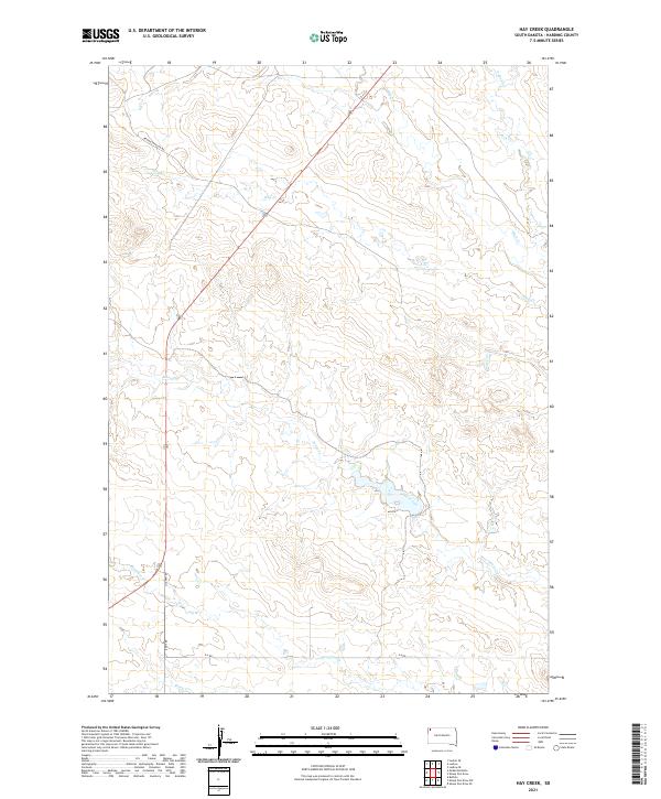
2021 Map of Hay Creek
USGS Topo · Published 2021About this map
Jones Creek and Hay Cr wind through this corner of Harding County, South Dakota, defining a landscape of high-plains drainage and sparse connectivity. This territory is marked by long-standing ranching routes like Brown-Johnson Rd and Lyons Rd, which follow the natural contours of the land rather than a strict grid. The presence of Old Hwy 85 indicates the evolution of regional transit, as the primary thoroughfare shifted slightly from its original course. Smaller tributaries like Boxelder Cr and Sheep Cr are prominent features in this section of the state's northwest corner, where water sources traditionally dictated the placement of early homesteads and grazing boundaries across Township 20 North and its neighbors. The map details the specific drainage patterns of Bull Cr and the split flow of Jack Cr and S Jack Cr in the northeastern quadrant.
Find a feature on this map
18 named features on this map. Tap any name to fly to it.
Don’t see what you’re looking for? This feature index may not catch every label — zoom into the map to look around manually.
Map Details
Editions of this 2021 Hay Creek Map
This is the sole edition of this map. No revisions or reprints were ever made.
Other maps of this area

1935 · Reva
USGS Topo · 1:125,000

1935 · Buffalo
USGS Topo · 1:125,000

1954 · Lemmon
USGS Topo · 1:250,000

1957 · Lemmon
USGS Topo · 1:250,000

1968 · Ludlow
USGS Topo · 1:24,000

1968 · Ludlow SE
USGS Topo · 1:24,000

1969 · Ladner SE
USGS Topo · 1:24,000

1971 · Buffalo
USGS Topo · 1:24,000
1971 · Sheep Pen Draw
USGS Topo · 1:24,000

1971 · McKenzie Butte
USGS Topo · 1:24,000