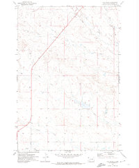
1971 Map of Hay Creek
USGS Topo · Published 1974About this map
Hay Creek and its many tributaries define this section of the rangeland in Harding County, where drainage patterns across the high plains dictate the movement of both water and travel. Mapped in the early 1970s, the landscape is marked by a complex network of seasonal watercourses including Bull Creek, Jones Creek, and Boxelder Creek. The passage of State Route 85 provides the primary north-south corridor through the territory, crossing the western half of the sheet. One distinctive detail provided by this survey is the inclusion of fence and field lines, noted as being visible on 1970 aerial photography. These boundaries, alongside the scattered Sheep Creek and Jack Creek drainages, offer a clear look at the large-scale livestock grazing operations that characterize this corner of South Dakota.
Find a feature on this map
8 named features on this map. Tap any name to fly to it.
Don’t see what you’re looking for? This feature index may not catch every label — zoom into the map to look around manually.
Map Details
Editions of this 1971 Hay Creek Map
This is the sole edition of this map. No revisions or reprints were ever made.
Other maps of this area

1935 · Reva
USGS Topo · 1:125,000

1935 · Buffalo
USGS Topo · 1:125,000

1954 · Lemmon
USGS Topo · 1:250,000

1957 · Lemmon
USGS Topo · 1:250,000

1968 · Ludlow
USGS Topo · 1:24,000

1968 · Ludlow SE
USGS Topo · 1:24,000

1969 · Ladner SE
USGS Topo · 1:24,000

1971 · Buffalo
USGS Topo · 1:24,000
1971 · Sheep Pen Draw
USGS Topo · 1:24,000

1971 · McKenzie Butte
USGS Topo · 1:24,000