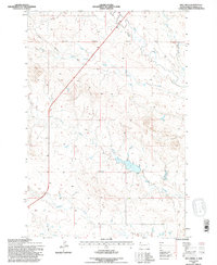
1993 Map of Hay Creek
USGS Topo · Published 1996About this map
Harrison Road provides the primary overland route through this remote section of Harding County, cutting across a landscape defined by an intricate drainage system. The area is marked by several prominent watercourses including Hay Creek and Jones Creek, which carve through the terrain and dictate the layout of the local range and section lines. Surveyed and updated in the late 20th century, the map documents the Standard Parallel North, a critical surveying baseline for the High Plains. To the south, Boxelder Creek and Sheep Creek establish the southern hydrological boundary, while Bull Creek and Jack Creek drain the northern reaches. This document highlights a ranching landscape where development is sparse, centered primarily on the infrastructure of essential rural roads and the natural flow of these semi-arid western waterways.
Find a feature on this map
8 named features on this map. Tap any name to fly to it.
Don’t see what you’re looking for? This feature index may not catch every label — zoom into the map to look around manually.
Map Details
Editions of this 1993 Hay Creek Map
This is the sole edition of this map. No revisions or reprints were ever made.
Other maps of this area

1935 · Reva
USGS Topo · 1:125,000

1935 · Buffalo
USGS Topo · 1:125,000

1954 · Lemmon
USGS Topo · 1:250,000

1957 · Lemmon
USGS Topo · 1:250,000

1968 · Ludlow
USGS Topo · 1:24,000

1968 · Ludlow SE
USGS Topo · 1:24,000

1969 · Ladner SE
USGS Topo · 1:24,000

1971 · Buffalo
USGS Topo · 1:24,000
1971 · Sheep Pen Draw
USGS Topo · 1:24,000

1971 · McKenzie Butte
USGS Topo · 1:24,000