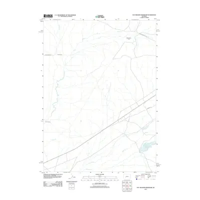
2012 Map of Hay Meadow Reservoir
USGS Topo · Published 2012About this map
Emigrant Trl and other historic overland routes dominate this high plains landscape in Sweetwater County, highlighting the region's enduring role as a corridor for westward movement. Modern roads like McCann Ranch Rd follow the same general trajectories as the ancient trails and the Lander Pinedale Stage Rd, connecting isolated outposts such as McCann Ranch. The hydrology of this arid environment is clearly defined by seasonal watercourses like Dry Sandy Cr, Sulphur Cr, and Pacific Cr, which converge or drain toward the southern basin. The primary water feature, Hay Meadow Reservoir, provides a critical catchment area in a landscape characterized by broad depressions such as Monument Draw. Traces of the 19th-century frontier are preserved in the alignment of the Dry Sandy Stage, illustrating how early transportation networks were dictated by the availability of water at intermittent creek crossings.
Find a feature on this map
13 named features on this map. Tap any name to fly to it.
Don’t see what you’re looking for? This feature index may not catch every label — zoom into the map to look around manually.
Map Details
Editions of this 2012 Hay Meadow Reservoir Map
This is the sole edition of this map. No revisions or reprints were ever made.
Other maps of this area

1955 · Lander
USGS Topo · 1:250,000

1958 · Lander
USGS Topo · 1:250,000

1958 · Parting of the Ways
USGS Topo · 1:62,500

1958 · Essex Mountain
USGS Topo · 1:62,500

1958 · Hay Meadow Reservoir
USGS Topo · 1:24,000

1958 · Tule Butte
USGS Topo · 1:24,000

1958 · Pacific Springs
USGS Topo · 1:24,000

1958 · Parting of the Ways
USGS Topo · 1:24,000

1958 · Freighter Gap
USGS Topo · 1:62,500

1961 · Lander
USGS Topo · 1:250,000