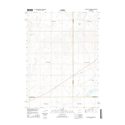
2015 Map of Hay Meadow Reservoir
USGS Topo · Published 2015About this map
Emigrant Trl cuts across this high desert landscape, marking the historic path of westward expansion near the meeting point of three Wyoming counties. The terrain is defined by a series of drainages, including Dry Sandy Cr and Pacific Cr, which flow through a region of complex jurisdictional boundaries between Sublette, Fremont, and Sweetwater Counties. This 2015 survey details the hydrology around the Hay Meadow Reservoir and Pacific Number 2 Reservoir, critical water management points in an arid environment. Local landmarks like Monument Draw and Hay Meadow break the upland plains, while the presence of Mccann Ranch Rd suggests the continued importance of ranching operations in this corner of the state. The map captures the intersection of historical transit routes and modern water infrastructure in a remote part of the Great Divide Basin.
Find a feature on this map
22 named features on this map. Tap any name to fly to it.
Don’t see what you’re looking for? This feature index may not catch every label — zoom into the map to look around manually.
Map Details
Editions of this 2015 Hay Meadow Reservoir Map
This is the sole edition of this map. No revisions or reprints were ever made.
Other maps of this area

1955 · Lander
USGS Topo · 1:250,000

1958 · Lander
USGS Topo · 1:250,000

1958 · Parting of the Ways
USGS Topo · 1:62,500

1958 · Essex Mountain
USGS Topo · 1:62,500

1958 · Hay Meadow Reservoir
USGS Topo · 1:24,000

1958 · Tule Butte
USGS Topo · 1:24,000

1958 · Pacific Springs
USGS Topo · 1:24,000

1958 · Parting of the Ways
USGS Topo · 1:24,000

1958 · Freighter Gap
USGS Topo · 1:62,500

1961 · Lander
USGS Topo · 1:250,000