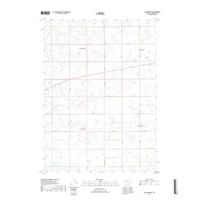
2017 Map of Hay Springs NE
USGS Topo · Published 2017About this map
Hay Springs Cr meanders through the high plains of Sheridan County, shaping a landscape defined by seasonal watercourses and rural section lines. This 2017 survey by the U.S. Geological Survey documents a remote corner of Nebraska where the township and range system remains the primary structural influence on the land. The presence of Musfelt Reservoir in the northeast serves as a critical point of water management in an area otherwise dominated by the intermittent flow of Rush Cr. The road network, including Strotheide Rd and Church Rd, follows the strict geometry of the Public Land Survey System, reflecting the enduring legacy of early settlement patterns and agricultural development. This map provides a precise view of the terrain as it existed just before the turn of the decade, noting the specific locations of rural routes like 610th Rd and 550th Rd.
Find a feature on this map
23 named features on this map. Tap any name to fly to it.
Don’t see what you’re looking for? This feature index may not catch every label — zoom into the map to look around manually.
Map Details
Editions of this 2017 Hay Springs NE Map
This is the sole edition of this map. No revisions or reprints were ever made.
Other maps of this area

1955 · Alliance
USGS Topo · 1:250,000

1957 · Alliance
USGS Topo · 1:250,000

1958 · Alliance
USGS Topo · 1:250,000

1960 · Hay Springs SW
USGS Topo · 1:24,000

1960 · Hay Springs SE
USGS Topo · 1:24,000

1966 · Rushville
USGS Topo · 1:24,000

1966 · Rushville SW
USGS Topo · 1:24,000

1966 · Hay Springs NE
USGS Topo · 1:24,000

1966 · Hay Springs
USGS Topo · 1:24,000

1969 · Clinton SW
USGS Topo · 1:24,000