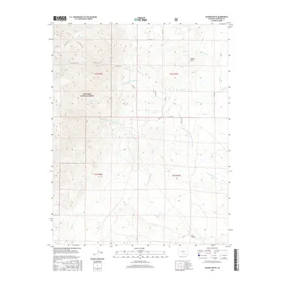
2016 Map of Hayden Butte
USGS Topo · Published 2016About this map
San Isabel National Forest dominates the western portion of this Huerfano County landscape, where the high-altitude terrain is defined by a complex network of canyons and arroyos. The map reveals a transition from the forested peaks to the open drainage basins of the east, anchored by the prominent Hayden Butte. This area serves as a significant drainage hub for several watercourses, including the N Apache Cr and S Apache Cr, which merge to form Apache Cr. The presence of several established routes such as the Bartlett Trail, Apache Falls Trail, and S Apache Trail indicates the historical importance of these corridors for navigating the steep elevation changes near Apache Falls. To the southeast, the landscape opens into broad washes like the Mexican Springs Br Greasewood Arroyo and Greasewood Arroyo, reflecting the arid drainage patterns of the Colorado high desert.
Find a feature on this map
28 named features on this map. Tap any name to fly to it.
Don’t see what you’re looking for? This feature index may not catch every label — zoom into the map to look around manually.
Map Details
Editions of this 2016 Hayden Butte Map
This is the sole edition of this map. No revisions or reprints were ever made.
Other maps of this area

1889 · Huerfano Park
USGS Topo · 1:125,000

1891 · Walsenburg
USGS Topo · 1:125,000

1892 · Huerfano Park
USGS Topo · 1:125,000

1894 · Walsenburg
USGS Topo · 1:125,000

1897 · Walsenburg
USGS Topo · 1:125,000

1900 · Walsenburg
USGS Topo · 1:125,000

1954 · Trinidad
USGS Topo · 1:250,000

1955 · Trinidad
USGS Topo · 1:250,000

1958 · Trinidad
USGS Topo · 1:250,000

1959 · Trinidad
USGS Topo · 1:250,000