Loading...
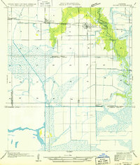
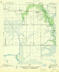
Loading map...1949 Map of Hayes
USGS Topo · Published 1949About this map
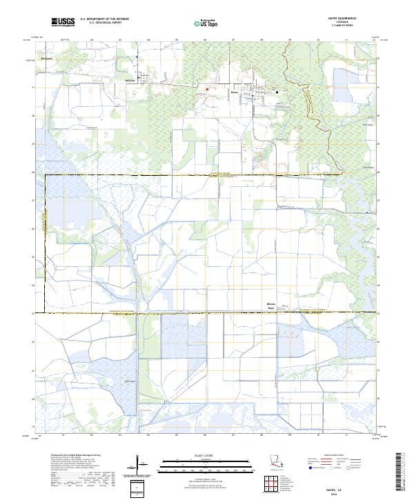
Hayes and Bell City anchor this coastal prairie landscape where the Southern Pacific railroad parallels State Highway No 98. The map reveals an intricate network of water management essential to the region's agricultural economy, from the Bell City Drainage Canal to various structures like the Guillory Pump House. The transition from the settled north to the southern wetlands is marked by the vast Willow Marsh and the winding course of Bayou Laccasine.
Find a feature on this map
21 named features on this map. Tap any name to fly to it.
Don’t see what you’re looking for? This feature index may not catch every label — zoom into the map to look around manually.
Map Details
Date Portrayed1949
Date Published1949
PublisherU.S. Geological Survey
Map TypeTopographic
Scale1:31,680
Physical Dimensions16.9 x 19.8 inches
Editions of this 1949 Hayes Map
This is the sole edition of this map. No revisions or reprints were ever made.
Historical Maps of Hayes Through Time
8 maps found
Featured Locations
Source Details
SourceU.S. Geological Survey
CopyrightPublic Domain