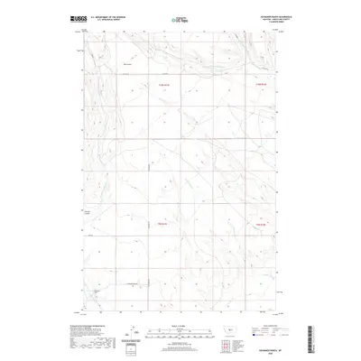
2020 Map of Haymaker Ranch
USGS Topo · Published 2020About this map
Haymaker Ranch stands as the primary landmark in this Montana landscape, where the high plains are carved by a complex drainage network. The terrain is defined by dramatic landforms such as Big Coulee in the north and Morrisy Coulee further south, illustrating the erosional patterns of Wheatland County. Water systems are particularly intricate here, with the W Fork Hopley Cr, Middle Fork Hopley Cr, and Hopley Cr converging in the northeast, while Mexican John Cr and E Fork Haymaker Cr drain the central and western reaches. The network of local roads, including Haymaker Rd and Olaf Rd, follows the natural contours of the coulees, reflecting how ranching operations and transportation have adapted to the Montana topography.
Find a feature on this map
17 named features on this map. Tap any name to fly to it.
Don’t see what you’re looking for? This feature index may not catch every label — zoom into the map to look around manually.
Map Details
Editions of this 2020 Haymaker Ranch Map
This is the sole edition of this map. No revisions or reprints were ever made.
Other maps of this area

1886 · Little Belt Mts.
USGS Topo · 1:250,000

1889 · Big Snowy Mountain
USGS Topo · 1:250,000

1893 · Big Snowy Mountain
USGS Topo · 1:250,000

1894 · Little Belt Mts.
USGS Topo · 1:250,000

1897 · Little Belt Mts.
USGS Topo · 1:250,000

1898 · Little Belt Mts.
USGS Topo · 1:250,000

1902 · Little Belt Mts.
USGS Topo · 1:250,000

1948 · White Sulphur Springs
USGS Topo · 1:250,000

1954 · Roundup
USGS Topo · 1:250,000

1958 · Roundup
USGS Topo · 1:250,000