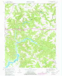
1968 Map of Haynesville
USGS Topo · Published 1980About this map
Totuskey Creek defines the landscape of central Richmond County, Virginia, carving a winding path through the timbered lowlands of the Northern Neck. In the late 1960s, this area remained largely rural, centered on established crossroads and farming communities like Haynesville and Emmerton. The map documents a traditional Southern social geography, noted by the density of local landmarks such as Jerusalem Ch, Mulberry Ch, and the Totuskey Ch Cem.
Find a feature on this map
45 named features on this map. Tap any name to fly to it.
Don’t see what you’re looking for? This feature index may not catch every label — zoom into the map to look around manually.
Map Details
Editions of this 1968 Haynesville Map
Other maps of this area

1892 · Piney Point
USGS Topo · 1:62,500

1892 · Montross
USGS Topo · 1:62,500

1894 · Piney Point
USGS Topo · 1:62,500

1895 · Nomini
USGS Topo · 1:125,000

1895 · Piney Point
USGS Topo · 1:62,500

1895 · Montross
USGS Topo · 1:62,500

1898 · Nomini
USGS Topo · 1:125,000

1901 · Piney Point
USGS Topo · 1:62,500

1917 · Morattico
USGS Topo · 1:62,500

1918 · Tappahannock
USGS Topo · 1:62,500