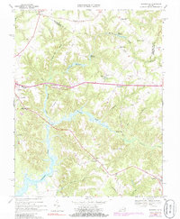
1968 Map of Haynesville
USGS Topo · Published 1985About this map
Totuskey Creek and its many meandering tributaries, including Little Totuskey Creek and Moores Mill Creek, dominate this survey of the Northern Neck during the late 1960s. The landscape is defined by its water-driven history, evidenced by Gardys Millpond, Garlands Millpond, and Hogans Millpond. These water bodies and their surrounding swamps, such as Drinking Swamp and Marshy Swamp, separate several small, established communities.
Find a feature on this map
50 named features on this map. Tap any name to fly to it.
Don’t see what you’re looking for? This feature index may not catch every label — zoom into the map to look around manually.
Map Details
Editions of this 1968 Haynesville Map
Other maps of this area

1892 · Piney Point
USGS Topo · 1:62,500

1892 · Montross
USGS Topo · 1:62,500

1894 · Piney Point
USGS Topo · 1:62,500

1895 · Nomini
USGS Topo · 1:125,000

1895 · Piney Point
USGS Topo · 1:62,500

1895 · Montross
USGS Topo · 1:62,500

1898 · Nomini
USGS Topo · 1:125,000

1901 · Piney Point
USGS Topo · 1:62,500

1917 · Morattico
USGS Topo · 1:62,500

1918 · Tappahannock
USGS Topo · 1:62,500