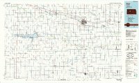
1985 Map of Hays
USGS Topo · Published 1985About this map
The Smoky Hill River and Walnut Creek define the horizontal grain of this High Plains landscape, where the Cedar Bluff Reservoir stands as a significant hydrological landmark. Along the northern corridor, the Union Pacific railroad anchors a string of prairie towns including Hays, Victoria, and Walker, reflecting the historical rail-town development pattern of central Kansas. Further south, the Missouri Pacific line serves settlements like La Crosse and McCracken, illustrating the dual-railroad economy that once drove regional commerce.
Find a feature on this map
61 named features on this map. Tap any name to fly to it.
Don’t see what you’re looking for? This feature index may not catch every label — zoom into the map to look around manually.
Map Details
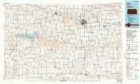
Editions of this 1985 Hays Map
2 editions found
Other maps of this area

1889 · Larned
USGS Topo · 1:125,000

1891 · Great Bend
USGS Topo · 1:125,000

1891 · Larned
USGS Topo · 1:125,000

1892 · Ness
USGS Topo · 1:125,000

1893 · Ellis
USGS Topo · 1:125,000

1893 · Great Bend
USGS Topo · 1:125,000

1893 · Hill
USGS Topo · 1:125,000

1894 · Ness
USGS Topo · 1:125,000

1896 · Osborne
USGS Topo · 1:125,000

1896 · Russell
USGS Topo · 1:125,000