Loading...
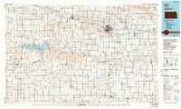
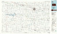
Loading map...1985 Map of Hays
USGS Topo · Published 1990About this map
The Smoky Hill River and Big Creek drain this expansive stretch of Western Kansas, where the high plains meet the organized grids of the 1980s. The city of Hays dominates the center of the sheet, supported by the Union Pacific RR which parallels the historic Overland Trail through Victoria and Walker. In the west, the massive Cedar Bluff Reservoir and its associated Cedar Bluff Canal define the irrigation and recreation landscape, flanked by the Cedar Bluff State Park.
Find a feature on this map
84 named features on this map. Tap any name to fly to it.
Don’t see what you’re looking for? This feature index may not catch every label — zoom into the map to look around manually.
Map Details
Date Portrayed1985
Date Published1990
PublisherU.S. Geological Survey
Map TypeTopographic
Scale1:100,000
Physical Dimensions40.88 x 24.53 inches
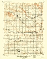
Editions of this 1985 Hays Map
2 editions found
Historical Maps of Hays Through Time
Featured Locations
Source Details
SourceU.S. Geological Survey
CopyrightPublic Domain