
1960 Map of Haystack Gulch
USGS Topo · Published 1962About this map
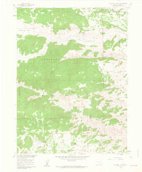
The Roosevelt National Forest defines this high-country landscape, where the headwaters of the Rabbit Creek system carve through steep terrain. Settlers and ranchmen in the early 1960s occupied isolated pockets like Log Cabin and Stuart Hole, while the Lone Pine Sch served as a remote educational outpost for families in the area. The map reveals a land utilized for both natural resources and seasonal grazing, evidenced by the Simons Quarry and expansive labels like Prairie Divide. A network of unimproved dirt tracks and the Red Feather Lakes Road provide the primary access through the canyons. This topographic study captures the transition between high prairies and mountain peaks, including landmarks such as Sheep Mountain and Haystack Butte, before more modern developments altered the rural character of this Larimer County region.
Find a feature on this map
22 named features on this map. Tap any name to fly to it.
Don’t see what you’re looking for? This feature index may not catch every label — zoom into the map to look around manually.
Map Details
Editions of this 1960 Haystack Gulch Map
4 editions found
Other maps of this area

1907 · Livermore
USGS Topo · 1:125,000

1909 · Livermore
USGS Topo · 1:125,000

1916 · Home
USGS Topo · 1:125,000

1920 · Home
USGS Topo · 1:125,000

1954 · Greeley
USGS Topo · 1:250,000

1957 · Greeley
USGS Topo · 1:250,000

1958 · Greeley
USGS Topo · 1:250,000

1960 · Livermore Mountain
USGS Topo · 1:24,000

1961 · Greeley
USGS Topo · 1:250,000
1962 · Poudre Park
USGS Topo · 1:24,000