
2015 Map of Hayti
USGS Topo · Published 2015About this map
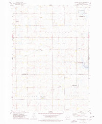
Hayti serves as the focal point of this Hamlin County landscape, situated on the eastern shores of Lake Marsh. The area is defined by the unique geography of the Coteau des Prairies, a vast highland plateau characterized by the glacial landforms known locally as The Coteaus. This 2015 survey reveals a strictly organized section-line road grid, including Redbird Ave and numerous numbered routes like 187th St, which overlay the ancient terrain. For researchers, the map provides precise locations for local landmarks such as Pleasant View Cem on the eastern edge of town and West Norden Cem to the south. The presence of Park Slough (historical) indicates a landscape in transition, where previous wetland features have been recorded even as the modern town and agricultural parcels evolve.
Find a feature on this map
20 named features on this map. Tap any name to fly to it.
Don’t see what you’re looking for? This feature index may not catch every label — zoom into the map to look around manually.
Map Details
Editions of this 2015 Hayti Map
This is the sole edition of this map. No revisions or reprints were ever made.
Other maps of this area

1953 · Watertown
USGS Topo · 1:250,000

1958 · Watertown
USGS Topo · 1:250,000

1969 · Hayti
USGS Topo · 1:24,000

1969 · Castlewood
USGS Topo · 1:24,000

1969 · Lake Norden
USGS Topo · 1:24,000

1969 · Pelican Lake
USGS Topo · 1:24,000

1969 · Watertown SE
USGS Topo · 1:24,000

1969 · Lake Poinsett
USGS Topo · 1:24,000

1973 · Bryant NE
USGS Topo · 1:24,000
1973 · Gertson Slough
USGS Topo · 1:24,000