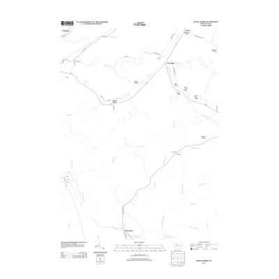
2013 Map of Hazel Hurst
USGS Topo · Published 2013About this map
Hazel Hurst serves as a central point in this northern Pennsylvania landscape, where a network of steep-sided valleys and ridges shapes the local geography. The area is defined by the convergence of several waterways, including Marvin Cr and Fivemile Run, which eventually drain south toward the East Branch Clarion River Lake. Small settlements like Marvindale and Kasson are tucked into these drainage basins, connected by winding routes like Warner Brook Rd.
Find a feature on this map
51 named features on this map. Tap any name to fly to it.
Don’t see what you’re looking for? This feature index may not catch every label — zoom into the map to look around manually.
Map Details
Editions of this 2013 Hazel Hurst Map
This is the sole edition of this map. No revisions or reprints were ever made.
Other maps of this area

1924 · Bradford
USGS Topo · 1:62,500

1926 · Bradford
USGS Topo · 1:62,500

1933 · Smethport
USGS Topo · 1:62,500

1935 · Mt. Jewett
USGS Topo · 1:48,000

1937 · Smethport
USGS Topo · 1:62,500

1940 · Mt. Jewett
USGS Topo · 1:62,500

1941 · Bradford
USGS Topo · 1:62,500

1944 · Bradford
USGS Topo · 1:62,500

1948 · Crosby
USGS Topo · 1:62,500

1948 · Wildwood Fire Tower
USGS Topo · 1:24,000
Featured Places
- Mount Jewett, PA
- Kasson, Hamlin Township
- Hazel Hurst, Hamlin Township
- Williamsville, Sergeant Township
- Jones Township, PA