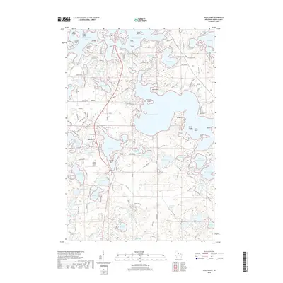
2018 Map of Hazelhurst
USGS Topo · Published 2018About this map
Tomahawk Lake and Minocqua Lake dominate this northern Wisconsin landscape, where complex shorelines are defined by landmarks like Kemps Point and Olmstead Island. The settlement of Hazelhurst sits between Katherine Lake and the Lower Kaubashine Lake, serving as a central point for the surrounding seasonal and permanent residential developments. The area is characterized by a dense network of local roads such as Blue Lake Rd and Lower Kaubashine Rd that provide access to dozens of smaller water bodies including Alice Lake, Jossart Island, and Baker Lake. Local history is anchored at Lakeside Cem, while the Circle A Ranch Airport indicates the region's mid-century evolution into a destination for aviation and recreation. This 2018 survey detail shows the modern concentration of properties along the many channels, such as the Tomahawk Thoroughfare.
Find a feature on this map
202 named features on this map. Tap any name to fly to it.
Don’t see what you’re looking for? This feature index may not catch every label — zoom into the map to look around manually.
Map Details
Editions of this 2018 Hazelhurst Map
This is the sole edition of this map. No revisions or reprints were ever made.
Other maps of this area

1938 · Minocqua
USGS Topo · 1:48,000

1938 · Lac Du Flambeau
USGS Topo · 1:48,000

1939 · Lac Du Flambeau
USGS Topo · 1:48,000

1939 · Mc Cord
USGS Topo · 1:48,000

1939 · Cassian
USGS Topo · 1:48,000

1942 · Cassian
USGS Topo · 1:48,000

1946 · Minocqua
USGS Topo · 1:48,000

1946 · Lac Du Flambeau
USGS Topo · 1:48,000

1947 · Mc Cord
USGS Topo · 1:48,000

1949 · Minocqua
USGS Topo · 1:48,000