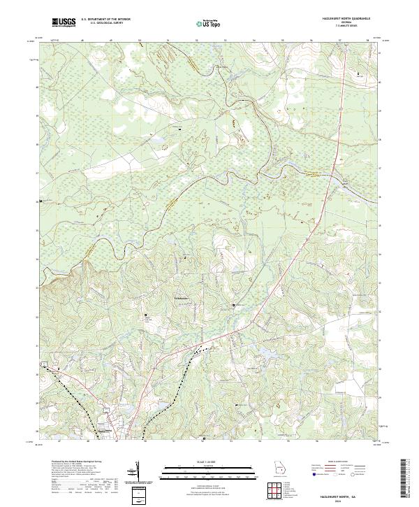
2024 Map of Hazlehurst North
USGS Topo · Published 2024About this map
The confluence of the Oconee River and the Ocmulgee River forms the headwaters of the Altamaha River in this rural stretch of Jeff Davis, Wheeler, and Montgomery counties. This river junction is a focal point of the local geography, featuring the Town Bluff Ferry and the nearby high ground of Town Bluff. The landscape is defined by its water-bound borders and the winding course of Gully Creek, which drains toward the southern edge of the sheet near Hazlehurst.
Find a feature on this map
110 named features on this map. Tap any name to fly to it.
Don’t see what you’re looking for? This feature index may not catch every label — zoom into the map to look around manually.
Map Details
Editions of this 2024 Hazlehurst North Map
This is the sole edition of this map. No revisions or reprints were ever made.
Other maps of this area

1953 · Waycross
USGS Topo · 1:250,000

1957 · Macon
USGS Topo · 1:250,000

1958 · Macon
USGS Topo · 1:250,000

1958 · Waycross
USGS Topo · 1:250,000

1964 · Macon
USGS Topo · 1:250,000

1970 · Alston
USGS Topo · 1:24,000

1970 · Uvalda
USGS Topo · 1:24,000

1970 · Jordan
USGS Topo · 1:24,000

1970 · Pine Grove
USGS Topo · 1:24,000
1970 · Grays Landing
USGS Topo · 1:24,000