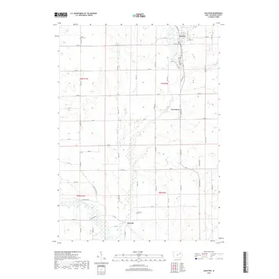
2018 Map of Hazleton
USGS Topo · Published 2018About this map
Hazleton serves as the primary hub in this portion of Buchanan County, situated along the northern reaches where Hazleton Lake and Hunter Cr converge. The landscape is a classic example of Iowa's organized agricultural grid, punctuated by small settlements like Bryantsburg and Otterville. Genealogists will find a high concentration of burial sites, including the North Amish Cem in the northwest and Saint Marys Cem near the town center, reflecting the area's diverse denominational history. To the south, the Wapsipinicon River meanders through the terrain, joined by Otter Creek. The intricate network of county roads, such as Co RD c57 and Co RD w13, connects these rural communities, illustrating a long-standing reliance on the land and the waterways that define this region.
Find a feature on this map
52 named features on this map. Tap any name to fly to it.
Don’t see what you’re looking for? This feature index may not catch every label — zoom into the map to look around manually.
Map Details
Editions of this 2018 Hazleton Map
This is the sole edition of this map. No revisions or reprints were ever made.
Other maps of this area

1901 · Oelwein
USGS Topo · 1:125,000

1903 · Winthrop
USGS Topo · 1:125,000

1954 · Waterloo
USGS Topo · 1:250,000

1955 · Waterloo
USGS Topo · 1:250,000

1959 · Dubuque
USGS Topo · 1:250,000

1961 · Dubuque
USGS Topo · 1:250,000

1962 · Dubuque
USGS Topo · 1:250,000

1971 · Fairbank
USGS Topo · 1:24,000

1971 · Littleton
USGS Topo · 1:24,000
1971 · Jesup
USGS Topo · 1:24,000