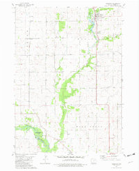
1981 Map of Hazleton
USGS Topo · Published 1982About this map
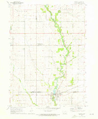
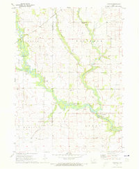
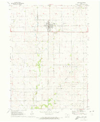
The Wapsipinicon River meanders through the southwestern corner of this Buchanan County landscape, anchored by the riverfront settlement of Otterville. Further north, the town of Hazleton serves as a primary hub, characterized by its grid of streets, St Marys Cem, and the recreational waters of Fontana Lake. The map reveals a deeply rooted rural infrastructure, evidenced by numerous numbered country schoolhouses like Wapsie Valley No 2 Sch and Prairie Grove Sch, alongside community landmarks such as North Amish Cem. An Old Railroad Grade cuts a straight line north-to-south through Bryantsburg, marking the path of former commerce. This 1981 survey documents a transition in the local economy, where traditional township school districts and rail-dependent hamlets meet modern land uses like the Otter Creek County Wildlife Area.
Find a feature on this map
31 named features on this map. Tap any name to fly to it.
Don’t see what you’re looking for? This feature index may not catch every label — zoom into the map to look around manually.
Map Details
Editions of this 1981 Hazleton Map
This is the sole edition of this map. No revisions or reprints were ever made.
Other maps of this area

1901 · Oelwein
USGS Topo · 1:125,000

1903 · Winthrop
USGS Topo · 1:125,000

1954 · Waterloo
USGS Topo · 1:250,000

1955 · Waterloo
USGS Topo · 1:250,000

1959 · Dubuque
USGS Topo · 1:250,000

1961 · Dubuque
USGS Topo · 1:250,000

1962 · Dubuque
USGS Topo · 1:250,000
1971 · Fairbank
USGS Topo · 1:24,000
1971 · Littleton
USGS Topo · 1:24,000
1971 · Jesup
USGS Topo · 1:24,000