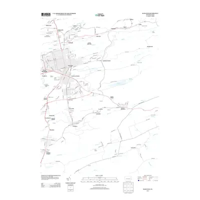
2013 Map of Hazleton
USGS Topo · Published 2013About this map
Hazleton Station and the urbanized grid of West Hazleton anchor this modern survey of Pennsylvania's coal region. The landscape is defined by its industrial legacy and complex water systems, with Black Cr and Hazle Cr threading through the northern half of the map while several reservoirs, including Dam F Reservoir, occupy the central interior. The settlement pattern is particularly dense, showcasing many smaller communities such as Beaver Meadows, Jeansville, and Ebervale that emerged around the region's historical mining activity. To the west, the Hazleton Municipal Airport and Cranberry Ridge provide a look at the modern infrastructure and natural elevation that frame the city's growth. This edition documents the region's transport network, from the street-level details of Old Sugar Loaf to the rural roads connecting McAdoo and Tresckow in the south.
Find a feature on this map
205 named features on this map. Tap any name to fly to it.
Don’t see what you’re looking for? This feature index may not catch every label — zoom into the map to look around manually.
Map Details
Editions of this 2013 Hazleton Map
This is the sole edition of this map. No revisions or reprints were ever made.
Other maps of this area

1889 · Hazleton
USGS Topo · 1:62,500

1891 · Wilkesbarre
USGS Topo · 1:62,500

1891 · Hazleton
USGS Topo · 1:62,500

1892 · Mahanoy
USGS Topo · 1:62,500

1893 · Hazleton
USGS Topo · 1:62,500

1893 · Mahanoy
USGS Topo · 1:62,500

1894 · Shickshinny
USGS Topo · 1:62,500

1894 · Wilkesbarre
USGS Topo · 1:62,500

1943 · Scranton
USGS Topo · 1:125,000

1944 · Newark
USGS Topo · 1:250,000