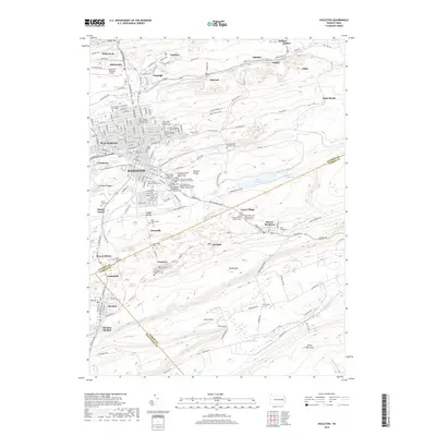
2019 Map of Hazleton
USGS Topo · Published 2019About this map
Hazleton serves as the focal point of this survey, revealing a landscape deeply imprinted by the ethnic and religious heritage of its residents. The sheer density of denominational burial grounds, such as Saint Joseph Slovak Roman Catholic Cem, Saint John the Baptist Polish National Catholic Church Cem, and the Serb-Montenegrin Cem, reflects the diverse immigrant populations that settled in this region of Pennsylvania.
Find a feature on this map
170 named features on this map. Tap any name to fly to it.
Don’t see what you’re looking for? This feature index may not catch every label — zoom into the map to look around manually.
Map Details
Editions of this 2019 Hazleton Map
This is the sole edition of this map. No revisions or reprints were ever made.
Other maps of this area

1889 · Hazleton
USGS Topo · 1:62,500

1891 · Wilkesbarre
USGS Topo · 1:62,500

1891 · Hazleton
USGS Topo · 1:62,500

1892 · Mahanoy
USGS Topo · 1:62,500

1893 · Hazleton
USGS Topo · 1:62,500

1893 · Mahanoy
USGS Topo · 1:62,500

1894 · Shickshinny
USGS Topo · 1:62,500

1894 · Wilkesbarre
USGS Topo · 1:62,500

1943 · Scranton
USGS Topo · 1:125,000

1944 · Newark
USGS Topo · 1:250,000